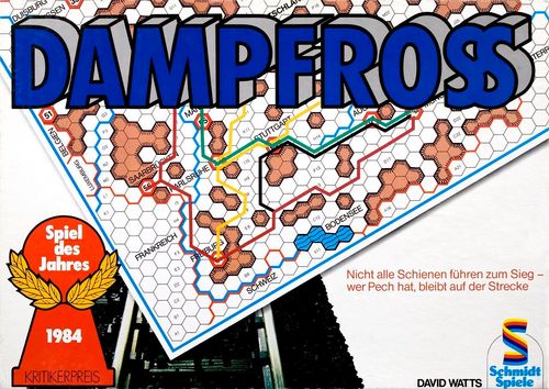
Dampfross
Dampfross Rulebook
Table of Contents
Table of Contents
Part I: The Building Phase
1. The First Round
The first player rolls (with one die) for all the other players, clearly visible to everyone. This value represents the building budget for all players this round: a roll of a "4," for example, means that every player may build up to four Credits worth of track this round. In turn, players build their routes by drawing them - in their own color - starting from a starting station on the map.
The starting stations for each map are given on pages 11 and 12.
Rail routes are always drawn from the center of one hex to the center of the next, through the middle of one side (see Figure 2). Building is only allowed where there is also a hex.
2. The Building Costs
All building costs are shown in Figure 1 (see right): as you can see, the building costs in open country from plain to plain, or into a city, are 1 Credit (Cr. for short). Building up onto a mountain (or down from it) costs 3 Cr. From one mountain to the next costs 5 Cr. Bridging a river always costs extra, i.e. +2 Cr.
So, for example, the combination of going from a plain across a river to a plain costs 3 Cr., and from a mountain across a river to another mountain costs 7 Cr.
Some maps have special features, such as wide rivers (see the "Kentucky & Tennessee" card, where bridging the wide Ohio can even cost +4 Cr.). However, all special cases are always clearly indicated.
No building is allowed abroad (an exception is the "Kentucky & Tennessee" card). All routes must end in the first hex beyond the border, or at a connecting station. Several such spur routes may be built into another country.
If, exceptionally, a "permitted route" through a foreign country exists, it is shown as a broad white line on the map. Building at the usual cost is allowed on these routes. Those parts of these special routes (or alignments) that are not built out are considered to be built by a (fictitious) foreign railway company - they may be used during the Operating Phase against payment of the usual fees.
Important: In the 1st phase of the game, building costs are "paid" with the die roll value; the money in the bank accounts may not be touched during the Building Phase. Any unbuilt Credits from a round are forfeited.
A suggestion: No routes should be drawn inside city hexes, as this would obscure the station's code number.
3. The Bank Accounts
Every railway president starts with a balance of 20 Credits. This amount is not affected by building costs during the Building Phase. Instead, two other factors can change the account balance:
Whoever is the first to connect a new city to their network is credited 6 Credits for it. Other players receive no points for this if they connect to this city later as well. Nevertheless, it is usually still very worthwhile to build into such a city, or to create a connection nearby, in order to reach it more cheaply during the Operating Phase.
If a player builds into a hex (Hex) in which another player's route already runs, they must pay a fee to that player (see the following section as well as Figure 4).
The account sheet above (Figure 3) can serve as a template for managing all bank accounts.
4. Payments to Rivals
If you build a connection or a crossing onto a fellow player's line, or even a parallel route in the same hex (see Figure 4), you must pay them Credits into their account. A connection is any joining of two or more differently colored routes - including crossings.
Connections - Every connection to a rival's line costs 1 Cr. All rail lines in a hex automatically meet at the center of the hex. So you cannot "paint around" each other.
Parallel routes - If a player builds parallel to an already existing route of another player in the same hex, they must pay that player 2 Cr. per half-hex for it. In addition, they must also pay 1 Cr. as a connection fee, since parallel rail lines also automatically have a connection at the center of the hex.
Cities - Within cities, no fees are paid to other players for connections or parallel routes.
Only for building a parallel route between two cities adjacent to each other is a special payment of 3 Cr. due to the fellow player (e.g. Nuremberg-Fürth on the Bavaria card).
Abroad - When building abroad, no fees for connections or parallel routes are paid to other players.
Important! If there are already lines of two or more fellow players in a hex, the corresponding fees must be paid to all rivals affected.
5. After the First Round
After the 1st round, the player who rolls the die and may draw their route first changes each round, in clockwise order. Otherwise, the same rules apply.
A player may extend their route however they like; they may build connections and split their budget between two or even more partial routes, but their network must always remain contiguous. They may therefore only continue building from a hex on which they already have a route.
On some maps it is useful to introduce the "Jump Rule" from the additional rules - see page 13 for this.
6. End of the Building Phase
Round by round, one city after another is connected to the various companies' rail networks.
When finally all cities except the last three are connected to the rail network - regardless of which company - the first phase of the game ends at that same moment. This applies even if some players have not yet had their turn in this round to build their routes.
Part II: The Operating Phase
In the second phase of the game, the owners of the railway lines undertake journeys between the cities. After every second journey, they may further expand their route network.
1. Journeys and Special Journeys
Every game has 21 journeys - of which 15 are journeys between stations and 6 are journeys to special destinations. An exception is - how could it be otherwise - Ireland; here there are a total of 18 journeys and no special journeys.
Each of the 36 stations on a map is once the start or destination of a journey. The stations are marked with a two-digit code between 11 and 66, and some cities have more than one station, i.e. code number.
Special journeys lead across national borders or to special locations (such as the ski resorts in the Bavarian Alps). All special destinations have a single-digit code from "1" to "6", which, however, is not on the card but is found on pages 11/12 with the respective special rules for the individual maps.
For each journey, both dice are rolled, with the red die giving the tens digit and the black die the units digit of a number; a red "3" and a black "5" thus give "35," which naturally refers to the station with the code number "35." The station of this city now forms the starting point of the journey. This dice-rolling process is then repeated for the destination station.
The 4th, 7th, 11th, 14th, 18th and 21st journeys of a game are always special journeys. For these, the starting station is rolled as described above, but the destination of the special journey is rolled with only one die.
Every map has a square journey chart to cross off the station codes already rolled.
Once more than half the journeys have been played out, the same codes are often rolled again. This can be shortened using the following method: if a number is rolled a second time, the next following code number is used instead; e.g. "45" instead of "44" and "51" instead of "46."
If a special journey crosses a national border, then, depending on the map, one may either build into any hex beyond the border, or to any connecting station in the destination country. Each player chooses the hex or connecting station most favorable to them. This hex may also be chosen by other players.
Important! The shortest existing route connection between the starting and destination station of a journey must be at least 3 hexes long. Otherwise the destination must be rerolled.
If a station is rolled that is not yet connected to the rail network, this journey is cancelled, and both stations (including the one that is connected!) are not travelled to in this game and are crossed off the journey chart.
2. Conditions for Participation
Every railway president decides for themselves whether to take part in a journey or not - the wealthiest company declares this first, and so on. Each participant clearly shows the others their exact route before the journey begins, which they may not change afterward, and places their railway playing piece at the starting station.
The route must lead at least partly over one's own section of track. One travels for free on one's own routes, but must pay 1 Cr. per hex to the owner before the journey begins for using foreign routes (even hexes used only half count as costing 1 Cr. in usage fees). The right to travel on a foreign route cannot be refused to any company as long as the fee is paid in full.
Per journey, a maximum of 10 Credits may be paid out for the use of a single company's route network. It is, however, permitted, for example, to use company A's route network for 9 Cr. and company B's for 8 Cr.
It is also permitted to offset the fees due for a journey against each other. An example: Company A wants to use B's route network for 15 Cr. in fees, while B in turn wants to use 12 hexes of A's network. This is allowed for both players despite the maximum of 10 Cr. each, because netting both payments comes to only 3 Cr. (from A to B).
3. Joint Journeys
Here, two companies join together - for one journey - and send a train on its way jointly. They split expenses and income equally, regardless of which routes are travelled by their players. Their train may use both route networks for free on this journey. If there are uneven payments, they are divided in favor of the poorer partner (so, for example, with earnings of 15 Credits, 8 Cr. go to the poorer and 7 Cr. to the richer company).
4. The Course of a Journey
After all usage fees have been paid, the journey may begin. In turn - the wealthiest railway president begins - each player rolls a die for their movement points and moves their playing piece forward along the previously determined route.
Travel from one hex to the next costs 1 point - regardless of whether it is on a plain, in the mountains, or across a river. Only the climb from a plain up onto a mountain costs 2 points (1 point of which is for the climb). Compare also Figure 5.
If the movement points are not enough to overcome a climb onto a mountain - if the player has only 1 point left of the needed 2 - the train stops at the hex border. It may then, in the next round, use 1 point to complete the rest of the climb and continue its journey according to its remaining points.
Important! Two or more trains may well be on the same hex, and all trains may also overtake one another.
5. The Winner of a Journey
When the first train reaches its destination, the others continue their journey. If two or more trains reach the destination in the same round, whoever still has the most movement points left after reaching the destination has won.
The winner receives 20 Credits and the second 10 Cr.; railway companies arriving later receive nothing for this journey. The bonuses are credited to the winners' accounts.
If two or more trains reach the destination with the same remaining movement points, they split the bonus, i.e. two joint winners each receive, for example, 15 Credits, or three who tie for second place receive 4 Cr., 3 Cr., and again 3 Cr. (with 4 Cr. going to the poorest).
6. The Scoring Track
After the end of each journey, it is crossed off on the scoring track with the numbers 1-21 on the game board, in order to keep an overview of (regular) journeys and special journeys.
7. Additional Building Measures
After every second journey, players may build new routes, for example to reach further cities or shorten their routes. But perhaps also just to annoy another player! In turn (the poorest first), each player may spend up to 10 Credits on new track construction. The costs for this are the same as in the Building Phase, but now they are paid directly from the railway companies' accounts.
In addition, any fees owed for connections and parallel routes (as in the Building Phase) must also be paid to other players.
8. The End of the Game
The game ends with the last journey. The railway president with the most Credits on their account has won.
If the time available for a game is limited, players may agree before the game begins to play out only 12 or 15 journeys.
On the following pages are the rules that apply specifically to individual maps, as well as the starting stations and special journeys for each map.
After that, on pages 13 and 14, are the two additional rules (the Jump Rule and an alternative bonus system) as well as the rules for 2 players.
Map-Specific Rules
Bavaria (Bayern)
Starting Stations
The starting stations on the Bavaria map are independent of the number of players: Munich or Nuremberg. Either can be used to begin building.
Special Journeys
To the connecting stations (1-5) or the ski resorts (6) in:
- Württemberg
- Hesse
- Thuringia
- Bohemia
- Austria
- Bavarian Alps
Notes
Building a parallel route between Nuremberg and Fürth costs 3 Cr. in fees.
From 5 players onward, use of the Jump Rule is recommended.
Russia (Rossija)
Starting Stations
All players start in Moscow, but in the first round each player may only leave the city in one direction.
Special Journeys
- Finland ("Finljandija") or Estonia ("Estonija")
- Latvia ("Latvija") or Belarus ("Belorussija") 3+4. Ukraine ("Ukraina")
- Georgia ("Grusija") or Azerbaijan
- Kazakhstan
Notes
At 6 players, use of the Jump Rule is recommended.
A note on the translation of Russian names: all names correspond to those in common use before the October Revolution; the German spellings are given in the right-hand column of the original where they differ. Names used only for a limited period are given in parentheses. Countries: Belorussija (Belarus), Estonija (Estonia), Finljandija (Finland), Grusija (Georgia), Latvija (Latvia), Ukraina (Ukraine). Waters: Azowskoe More (Sea of Azov), Beloe More (White Sea), Finski Saliv (Gulf of Finland), Kaspieskoe More (Caspian Sea), Osero Ladoga (Lake Ladoga), Osero Onega (Lake Onega), Severnaja Dvina (Northern Dvina), Tschornoe More (Black Sea). Places: Ekaterinburg (31, later Sverdlovsk), Ekaterinodar (64, later Krasnodar), Kirov (23, formerly Wjatka), Moskwa (51-53, Moscow), Nischny-Nowgorod (43, later Gorki), Nischny-Tagil (26, Nishne-Tagilsk), Petrosawodsk (14, formerly Kalininsk), Samara (45, later Kuybyshev), St. Petrborg (11-12, later Leningrad, now St. Petersburg), Turinsky (25, formerly Serow), Werchne-Uralsk (33, later Magnitogorsk), Zarizyn (62, later Stalingrad, now Volgograd).
Kentucky & Tennessee
Starting Stations
- At 3 players, all companies start in Louisville.
- At 4 players, 2 start in Louisville and 2 in Nashville.
- At 5 or 6 players, each may choose any city.
Special Journeys
- At Memphis or Cairo, across the Mississippi; the bridging costs 4 Cr. extra in each case.
- To Cairo/Illinois, Paducah/Kentucky, Evansville/Indiana, Louisville/Kentucky or Cincinnati/Ohio. The cities of Paducah and Louisville are a special case: here, the Ohio must additionally be bridged in order to reach the neighboring state.
- To Cincinnati/Ohio, Portsmouth/Ohio or Kenova/West Virginia. The city of Kenova is a special case here too: the Ohio must additionally be bridged here to reach the neighboring state of Ohio.
- To one of the five connecting stations in Virginia or West Virginia.
- To one of the seven connecting stations in the states of North Carolina or Georgia.
- To one of the ten connecting stations in Mississippi or Alabama.
Notes
Important! On the Kentucky & Tennessee map, building through foreign territory is permitted anywhere.
Bridging the Ohio costs either 2 or 4 Credits extra, depending on the width of the river.
Ireland
Starting Stations
The starting stations on the Ireland map are independent of the number of players: Belfast or Dublin. Either can be used to begin building.
Special Journeys
No special journeys are held on the Ireland map!
Notes
The 3 stations of the ferry ports Larne, Dun Laoghaire and Rosslare all share the (same) code number "11". If this code is rolled as the start or destination of a journey, each railway president may independently choose which of these three stations to travel to.
Part III: The Additional Rules
The following rules may be used in addition (the Jump Rule) or as an alternative (the different bonus system). Use of an additional rule must, of course, be agreed upon by all players before the game begins.
1. The Jump Rule
This additional rule should be used for very mountainous maps; for example, when six or more railway companies are active on the Russia map, or more than four on the Bavaria map.
The Jump Rule allows a player to extend their network with gaps. Specifically, when building along a foreign railway line, a player may make "jumps" of up to 3 hexes between two of their own connections (compare Figure 6). In doing so, they connect their route to a foreign network and may then leave up to 3 hexes of the foreign route unbuilt before continuing their own route there. Both connections must, of course, be paid for.
Each player may make only one or two such jumps per game in the same player's route network. Thus, for example, in a 4-player game, each player may make up to 6 jumps (max. 2 per fellow player). If a later expansion of one's own route connects the two separated route sections, that player is entitled to a further jump.
2. A Different Bonus System
Especially when playing with children, it can make sense for all participants in a journey to be rewarded - not just the first and second place. Under this bonus system, 30 Credits are distributed among all participants of a journey according to the table below.
A player may not participate if their journey route is more than twice as long as the shortest route used in that journey.
This bonus system extends the playing time by approximately 15 to 30 minutes.
| Placement: | 1st | 2nd | 3rd | 4th | 5th | 6th |
|---|---|---|---|---|---|---|
| Two players | 20 | 10 | - | - | - | - |
| Three | 16 | 9 | 5 | - | - | - |
| Four | 13 | 8 | 5 | 4 | - | - |
| Five | 11 | 7 | 5 |
3. Dampfross for Two Players
Dampfross is not really a game for 2 people, but with one of the following methods it can still be played by two:
a. There is an imaginary 3rd player. Let's call them David. In the Building Phase, the players alternately extend David's route network. David pays all applicable fees, but always only to whichever player is not currently controlling them.
If, in the Operating Phase, only one player takes part in a journey, the other may take over David's railway playing piece; here too, payments for the use of foreign routes are made only to whichever player is not controlling David. This system works well, but unfortunately David tends to win rather often...
b. Each player maintains two railway companies, each with its own color. Both of a player's companies may take part in the same journey simultaneously. This can be especially worthwhile if they swap track rights or travel together. With this method, the player with the highest combined Credit total from both companies wins.
A note on the color wax pencils: wipe the colors off after playing with a dry cloth. High-quality pencils have been deliberately chosen that leave no residue when normally pressed on for track-drawing. If you will not be playing for an extended period, be sure to wipe the colors off before putting the game away, so that your last route networks leave only a lasting impression in memory.
Designer's Notes
Every player's goal in Dampfross is to build the best possible railway network. The maps in this box were chosen so that route-builders are set different tasks by them.
The Ireland map is the fastest and easiest to play: new players should therefore try this map first. All the maps play well with four players; Ireland is also suitable for three players, but with five it gets a little crowded. Russia is good for five players, and Kentucky & Tennessee has room for up to six players. If more than four players are travelling in Bavaria, the "Jump Rule" should be used.
My maps are meant to encourage players to build (re-)actual rail routes. Your chances of winning improve if you know something about the geography and railway history of a region or country. That is why I have gathered a few points about the history of the railways in the respective countries on the following six pages.
As in real life, you must bear the following in mind when playing Dampfross:
Obstacles: rivers and mountains raise the cost of building track and thus slow it down.
Traffic flow: which areas and cities need to be connected in order to achieve the best possible return?
Competition: route-building is always influenced by what the other players do.
There are no patent recipes for winning, because playing is an art, not a science!
A tactic that works once may prove useless in another game, even on the same map. But there are a few generally valid guidelines:
- The other regions of the map can be reached faster from the center.
- Connections should be laid out at an angle that takes the main direction of traffic flow into account.
- A long, straight route through the center with many short branches offers the best opportunities for later expansion routes.
- A monopoly in an area always pays off: one should strive for one and, at the same time, make sure no one else achieves one!
- The 6 Credits for the first connection to a city are only pocket money by comparison: "real" money is earned from the journeys in the Operating Phase. City connections yield only about 200 Cr., while journeys yield about 600 Cr. per game.
- One should watch out for who the strongest rival is. That player should be paid as little as possible, and their plans disrupted whenever possible (e.g. by building into their territory).
- One should remember that the maps were designed so that, in play, the routes that actually exist arise: it is therefore worthwhile reading the notes on the respective maps.
- Before erasing the routes after a game, one should study them carefully to work out why some route networks were more profitable than others.
- Whoever plays frequently, and additionally with varying numbers of players, improves their chances.
I wish all Dampfross players lots of fun and always a good journey!
— David Watts
Railway History: Bavaria
In the history of German railways, Bavaria holds a special place, as Germany's first line was built from Nuremberg to Fürth in 1835. By 1861, a simple network had developed under state control that connected most regions of the state - though along very long and roundabout routes, as can be seen from the fact that most of today's main connections did not exist earlier.
As trade increased and the demand for rail connections grew, shorter main lines were built between the major cities. In response to the demands of many smaller communities, connecting lines were built to almost all towns and larger villages, leading to a very extensive network, 90% of which still exists today.
Bavaria is the largest south German federal state. High mountains stretch along the southern and eastern borders, but most of the land consists of hilly terrain that is not very high and, outside the valleys, is even rather flat.
Although the map looks mountainous at first glance, there are many ways around, so that in most games it is not necessary to build over mountains. One difficulty lies in the slight narrowing of the country in the middle. This means it often comes to a race between all players to reach the central area in the Nördlingen-Ingolstadt-Regensburg region.
Aside from the two centers - Nuremberg and Munich, which are also the starting points on our map - Bavaria is fairly evenly populated. Correspondingly, the rail lines are also spread across the whole country. Whoever possesses a direct connection between the traffic centers of Nuremberg and Munich is in a very strong position! Realistically, though, one cannot expect to open up more than about 60% of the map at best.
More often than on the other maps, joint journeys will occur in Bavaria between players who started from the two centers. One should therefore consider planning the route network with this in mind from the outset - it makes little sense to build parallel to another player's routes in the center if one will later undertake numerous joint journeys with that player!
At 5 or 6 players, the "Jump Rule" (see page 13) should be used on the Bavaria map to allow for a more interesting game.
One difficulty in designing this map was that several important cities (e.g. Ingolstadt, Regensburg and Passau) lie on both sides of a river, and the station is usually located - with respect - on the less important side! We therefore decided to draw each city on the side of the river on which the station was located at the time, or is still located today.
Taken all together, the Bavaria map is certainly harder to play than the other maps in this box, and experienced players will probably have more fun with it than beginners.
Railway History: Ireland
By the middle of the 19th century, Ireland had a fairly large population of 3 million people. Most of them, however, were impoverished farmers who had little use for the railway. Moreover, the population steadily declined - it halved within only a hundred years. Heavy industry barely developed, and there was little coal and iron. Moreover, apart from Dublin and Belfast, there were no large cities.
Despite all this, Ireland had a good railway network. Except for a few villages in the west, no place was more than 15 km from a station. This was partly due to the - for the Victorian era typical - optimism: even if there was not yet much to be earned with the railway, business would surely develop! Moreover, the large landowners supported railway development in order to raise the value - and thus the rent - of their land. Finally, national and regional governments gave loans and paid subsidies to the railway companies.
Ireland is a fairly flat country, and despite its boggy character it is therefore not very difficult to lay rails. There are mountainous areas, especially near the coast, but there are always enough routes between or around the mountains, so there are very few tunnels.
The largest cities are the most important ports: Dublin, Belfast, Cork, Waterford and Limerick. And it was precisely these ports that were naturally also the starting points of most rail lines. In the poorer mountain regions, not even the greatest optimist could hope for a "big" railway. So no fewer than 18 narrow-gauge railways were built. Mostly they were short connecting lines between small towns and agricultural centers or a market town. On "market day," there was then often as much traffic as in the whole rest of the week combined.
Against this background, there were therefore only very few large and prosperous companies, all working on the same pattern, building lines from Dublin, Belfast and other ports into the country. These lines gradually expanded, either through new construction or the purchase of weaker companies, and served an increasingly larger area. Besides these, there were numerous smaller companies, each with one or two short lines, meeting the main lines in large and small market towns.
Three major companies covered about 90% of Ireland. The "Great Southern & Western" was founded in 1844 to build the main line Dublin-Cork. Determined to keep its monopoly, it swallowed many smaller companies, such as the "Waterford & Limerick," which had built through the GSW's territory as far as Sligo.
The "Midland Great Western" was founded in 1845 and began building a line from Dublin to Mullingar. The usual pattern of construction and acquisition of small companies led it through the middle of Ireland to four places on the west coast.
The "Great Northern" (one of its impressive locomotives - the Kestrel - can be admired on page 9) was formed in 1870 by the merger of three companies, which jointly built the main line Dublin-Drogheda-Portadown-Belfast. It expanded to the west just like the MGW and the GSW, and took over the rich northwest: Dundalk-Enniskillen-Derry.
The "Belfast & N. Counties" was significantly smaller, but its main line connected the business cities of Belfast and Strabane.
The "Dublin & SE" included the very early line from Dublin to Dun Laoghaire, opened as far back as 1834, and the line with the weighty name "Waterford, Wexford, Wicklow & Dublin," as well as the even weightier - though entirely accurately named - line "Dublin, Rathmines, Rathgar, Roundtown, Rathfarnham & Rathcoole"!
The "Sligo, Leitrim & North Counties" was the only company that operated a well-functioning connection between two larger rail networks. Other apparent connections, such as the "Clogher Valley" and the "Cavan & Leitrim," were merely narrow-gauge lines on which, naturally, no through traffic was possible.
The overwhelming majority of the smaller companies at the edges of the island operated narrow-gauge railways. Most lines were short, but in the far northwest both the "Londonderry & Lough Swilly" and the "County Donegal Joint" had a network of more than 1,500 km. The most unusual line was the "Listowel-Ballybunion," a 15 km single-rail line (on the Lartigue system) near Tralee, which was closed down in 1924.
The partition of Ireland in 1922 led to a consolidation of all lines in the new (southern) Republic of Ireland into the "Great Southern Railway," except for the lines across the border.
It was inevitable that many lines were closed in the following 40 years - well over half of the rail network is no longer used today, and all the narrow-gauge lines have disappeared over the years. Almost all lines crossing the border, except the main connection between Dublin and Belfast, no longer exist. And this one has often been closed due to IRA bombings - although it is not clear to me how interrupting the only rail connection between the north and south of Ireland is supposed to help Irish unity.
In the game, it is quite likely that far more lines will be built than Ireland ever actually had!
A second or even third Dublin-Cork connection, and also more north-south connections than in reality, will keep coming up. Many short connections - that were missing, or never completed, because they would have drawn profitable traffic away from existing lines - may also get built, including the lines from Sligo to Donegal, a direct coastal connection from Cork to Waterford, the line from Wicklow to Kilkenny, and through the area behind Drogheda.
Altogether, the railway network that Ireland might have had, if it had had a greater supply of iron and coal, may well come into being this way!
Railway History: Russia
Russia is the largest state of the former USSR. Most of its inhabitants live in the comparatively small European part, which is nevertheless larger than the whole EC put together!
On its southern border lies the Caucasus, the highest mountain range in Europe, which in 1992 still had not been crossed by a railway line. The lines to Georgia and Azerbaijan run through the plains along the Black Sea and the Caspian Sea, which cannot be crossed by rail in our game (in a few cases there was a railway there before the reservoirs were built!) and so help decide the route.
The route of the line built in 1851 between Moscow and St. Petersburg (Leningrad) was determined by the Tsar, who laid his ruler on a map and drew a straight line!
In the east lies the Urals. They look impressive on the atlas - a long straight line with plains on both sides. In fact, however, they present no significant obstacle, since there are many relatively easy crossings.
The rest is part of the great North European Plain - low-lying, often marshy and relatively flat. There are two strips of somewhat hillier country: one between Moscow and the western border, the other between Moscow and the Urals.
Although these hills, with elevations of around 300 meters above sea level, are not very high, they still cause the rail lines to deviate from dead-straight routes. A greater obstacle is formed by the lakes and large rivers. Along the Volga and the Don there are many dams that create artificial reservoirs, which in our game cannot be crossed by the railway (in a few cases there was a railway there before the reservoirs were built) and so help decide the route.
Many early lines were built by private companies on behalf of the state. In 1913 there were still 13 private and 25 state lines. After 1917, all lines came under state control, and many new ones were also built besides.
Most lines were built for freight traffic, and because speed was not so important for this, the lines were often not laid as directly as they could have been.
The population outside the big cities is fairly evenly distributed; only the north is more sparsely populated due to the cold.
The Urals are one of the most mineral-rich regions in the world. Most cities lie on the eastern side (which makes the game more interesting). It is almost impossible to win without a line into the Urals. The gap near Sverdlovsk is an obvious target for everyone.
Everywhere, the scattered hills and the lakes along the rivers make it not as easy as one might first think to copy a rival's route.
Note the double special journeys into Ukraine. Because of the good soil and the huge coal and iron deposits, there is heavy traffic between Ukraine and Russia.
Through route connections to the isolated northern ports of Murmansk and Arkhangelsk, as well as the northeastern coalfield, good profits can be made. Whether two routes to these widely separated places are worthwhile is questionable.
If the other players allow it, one should try to build a rail triangle Moscow-Ufa-Zarizyn (Volgograd/Stalingrad), with short branch lines to other places.
The map is well suited for 3-5 players; if 6 want to play, no single player can cover even half the map unless the "Jump Rule" is used. Although the map is more extended from north to south than from east to west, there are more east-west journeys, especially between the Urals and the Moscow area.
Altogether, this map is harder to play than it may at first appear.
Railway History: Kentucky & Tennessee
These two inland states of the USA are bordered on the west by the Mississippi and on the north by the Ohio. In the south, a dead-straight border separates them from the neighboring states of Mississippi, Alabama and Georgia. In the east, the Appalachians form a considerable barrier; although they rise to "only" about 2,000 meters, they run in parallel mountain ranges in a SW-NE direction. A large valley reaching from Chattanooga to Bristol makes it easy to build in that direction, but lines from west to east, and especially from north to south, will have to build tunnels through the mountains.
In the west and north there are plains sloping gently down to the Ohio and Mississippi. Here the main obstacles are the tributary rivers, especially the Tennessee and the Cumberland near Paducah, where they run parallel.
In the center stretches a broad plateau: many valleys offer plenty of possible routes, but the area is quite sparsely populated, so it is uninteresting for a rail line - except that it must be crossed! Right in the middle of the map, at the Cumberland valley, lies one of the two largest areas east of the Mississippi in the USA without any rail lines.
Apart from this nearly empty center, the population is fairly evenly distributed. The larger cities mostly began as river ports, and the first railways naturally ran out from these ports, which in turn led to faster growth than in other cities. Through the meeting of several rail lines, these cities became important junctions where various lines met to exchange their cargo. Besides local traffic in the big cities, through traffic plays a major role: trains from the inland states of the north and west meet trains from the ports on the Gulf of Mexico in the south and on the Atlantic in the east, beyond the borders of this map.
A significant share of the rail traffic originating in Kentucky itself has its origin in the coalfields in eastern Kentucky around the towns of Middlesboro, Hazard and Pikeville. This is one of the largest coalfields on Earth, and more is mined here today than in the famous coal states of Pennsylvania and West Virginia. The rail lines in eastern Kentucky accordingly have many short branch lines reaching into the mining valleys.
The leading railway company in this region was the "Louisville & Nashville." Known as the "Old Reliable," it was one of the few American railway companies to survive 100 years without a change of name or a bankruptcy. Determined to remain the leading line in the region, it expanded its network and bought up competing companies, so as to cover almost all of Kentucky and the greater part of Tennessee, as well as large parts of other states.
The "Nashville-Chattanooga-St. Louis" company, like many American railway companies, does not reach all the cities in its name! Its main line runs from Chattanooga via Nashville to Memphis. The Paducah line forms a connection to other rail lines, which do in fact lead to St. Louis. The L&N had long known how well the NC&ST.L would fit into its network and slowly bought up a majority of its shares. The final merger came in the 1950s.
The "Southern Railway," as part of its huge network across almost the whole USA, has important lines in this region. Especially important are the lines from Chattanooga to Cincinnati, which has a proud 27 tunnels, and to Memphis, where it connects with many other railways.
The line of the "Tennessee Central" runs, as its name suggests, from west to east through the state and forms a connection between the "Southern" and the "Illinois Central."
The "Illinois Central" reaches south through western Kentucky and Tennessee to the Gulf of Mexico. It came into conflict with the "Gulf, Mobile and Ohio," which spread through the same territory in the opposite direction. Both companies merged only in the 1960s to form the "Illinois Central Gulf."
The "Chesapeake & Ohio," an important coal transport line, reaches through northeastern Kentucky on its way to Chicago and has important branches to the coalfields and to Lexington.
The "Norfolk & Western," another important coal transport line, also extends into the area but lies mostly outside Kentucky, except for short mining branch lines that cross the Big Sandy River, the state's northeastern border.
The "Clinchfield," half-owned by the L&N since 1926, is a short but heavily used line that needed 55 tunnels on its difficult route through the mountains!
As already described, these companies existed from about 1890 to the 1950s. Since then, most of the roughly 100 independent railway companies in the USA have merged into 6 large groups, which together control over 90% of today's rail network. They run exclusively freight trains - there are almost no passenger trains, apart from the few operated with subsidies from the national ("Amtrak") or local governments. The "Norfolk & Western" swallowed several other systems in the 1960s, formed a large group, and then merged in 1981 with the Southern to form the "NWS Corporation."
The so-called "family lines" (L&N, NC&ST.L, Clinchfield and others) merged in the same way with the so-called "Chessie System" (C&O, Baltimore & Ohio, etc.) to form "CSX." An interesting result was the "Deanne Connection" between Pikeville and Hazard. A one-kilometer stretch of new track shortened the coal trains' route to Georgia and North Carolina by 300 km!
Today, the "Illinois Central Gulf" is the only other railway company in this area, and it is widely known that it hopes to be taken over by a larger group.
On this DAMPFROSS map, it is fairly easy to build southwest from the Cincinnati-Lexington-Louisville area to Memphis; a little harder on the three sensible routes south to Chattanooga; but the east-west routes are more limited. One should bear in mind that both Chattanooga and Memphis are not just "twin cities," but also form connections to other states. The map design is meant to prevent players from building through the "dead" area between Nashville and Somerset in the center. One may not build across the Mississippi - and this is also not necessary; but a route from Evansville through South Indiana to Louisville and Cincinnati can be worthwhile for a player starting in Nashville, for whom the normal route to Louisville-Lexington is blocked.
Kentucky & Tennessee is by no means an easy map to play, and there are often very close finishes.
The Kentucky & Tennessee map has room for up to 6 players, but then one must plan a large number of joint journeys with fellow players who started from a different city.
The History of a Game
The following account of Dampfross's publishing history was written by Matthias Stobbe, a Dampfross fan, games critic and friend of David Watts, at the author's request.
The Unloved Teaching Aid: The Beginnings of a Modern Classic
Hardly any contemporary game has as eventful a history as DAMPFROSS. As early as 1948, its author, the Welshman David Gwyn Watts, put his first ideas on paper. A landscape overlaid with a hex grid was, however, all that hinted at today's game. Nothing more happened until the mid-1960s.
It was David Watts's chosen profession of geography teacher that finally gave the decisive impetus to revive the idea from his youth. In a playful way, students were to be shown the relationship between landscape, settlement and transport routes. For this reason, the game boards were always developed based on reality.
David Watts first traced the existing and former rail lines onto graph paper. Only afterward did he choose the exact position of towns and terrain obstacles - mountains and rivers - so that, when playing, the resulting routes would resemble real ones as closely as possible. But however good the idea seemed at school, DAMPFROSS did not catch on and was not especially popular with pupils.
Teaching colleagues and other adults, however, found the "traffic-geographic simulation" much more enjoyable than the students did.
From around 1969, DAMPFROSS was therefore available by mail order under the name "Railway Rivals," and slowly but surely the self-produced copies gained wider circulation. It was not for lack of trying on the packaging: the game consisted only of photocopied rules and a few A4 sheets overprinted with a numbered hex grid. Another sheet indicated on which fields the mountains and cities were to be drawn and where the rivers were located. Depending on the artistic ambition of the buyer of such a "do-it-yourself kit," it took some time before a playable board came into being. Transparent film and felt-tip pens allowed for repeated use.
A side effect of the (unavoidable, for hand-drawn) field numbering was that DAMPFROSS could also be played by post. All one needed was a game master, to whom the participants sent their building orders, and a newsletter that regularly published the results and the instructions for the new round. The first postal game started in March 1976 and lasted ten months; for the record, a certain T. Ball won.
To promote sales of his game, David Watts started his own postal-games magazine in September 1977, which to this day remains an inexhaustible source of new rule variants and game board prototypes.
From the "Isle of Man" as the smallest to "China" as the largest map, about 40 countries and regions have so far been offered as DAMPFROSS maps. Probably the best-known oddities are the Fiji Islands, and - mind you, neither official nor licensed - the best-known of all fantasy worlds: J.R.R. Tolkien's "Middle-earth."
First No Mountains... Then Too Many: Dampfross in Germany
DAMPFROSS eventually reached Germany by a roundabout route: the Swiss journalist Walter Luc Haas can claim credit for turning "Railway Rivals" into "Dampfroß." Through his involvement in the postal-games field, he came to know and value it so much that in 1976 he devoted a short review to it in the first issue of his own magazine "Joker." He also succeeded in placing the game in the "Bütehorn" game series of the Buchholz Verlag in Sarstedt. Although an impressive packaging in book-box format was chosen there, the materials were a clear step backward. With six maps from non-overprinted paper per region (Germany, England and the East Coast of the USA) and ordinary colored pencils, only 18 games were possible in total. Only the third edition fixed this shortcoming and included film-overlaid maps and fiber-tip pens.
A far greater problem with the Bütehorn edition caused a rather unfortunate start: in the first edition, the mountains were simply left off the Germany map altogether. Although this made route-building considerably easier, the players got a rather tedious impression of railway construction in Germany.
Regardless of this, the game achieved success with a place on the Best List for Game of the Year 1980. For David Watts, the award unfortunately meant little beyond the honor. The license did not bring in a single penny, because before the first royalties could be paid out, the Buchholz Verlag had to withdraw from the market.
DAMPFROSS disappeared - but not for long. In 1984, the firm Schmidt Spiel + Freizeit took up the matter. They acquired the license but had no close contact with the author and simply made the maps themselves for the sake of simplicity. The concept: take a map, overlay a grid - the DAMPFROSS board is done - but it did not work out. When the first copies were about to be shipped, fierce criticism arose in expert circles and the "trade press" over this version: particularly criticized was the "USA-West States" map, on which the Rocky Mountains stretched unbroken from north to south across a band six fields wide - a truly insurmountable obstacle that would have made even the experts of the Union Pacific give up.
The error was, however - this time with the author's involvement - fixed quickly enough to earn the game its greatest honor to date: being chosen "Game of the Year 1984." The game was without doubt a worthy prizewinner. David Watts made the most of this turn of fortune - over 400,000 copies of the Schmidt edition were sold in Germany alone - the early retirement he was offered. He could now devote himself entirely to his two passions: his wife Anne, and developing new game ideas.
But the story of DAMPFROSS is far from over with the "Game of the Year 1984" award: the Schmidt company also published the game with subsidiaries in France and Holland, and - at last - David Watts found a publisher in England too, who brought his "Railway Rivals" to market in a very handsome edition in 1985. That this publisher was Games Workshop, where the opportunity to publish the game had previously been turned down several times, is surprising nowadays. In 1985, however, it fit rather well into GW's program of contemporary games by well-known designers.
More recently a Swedish edition has been added, which the editor (and games designer) Dan Glimne brought out at the Alga publishing house under the title "Rail," and DAMPFROSS was even available for years in the former CSSR. However, the author has never seen any licenses or complimentary copies of this edition.
With the new edition in the Author's Edition at Laurin, David Watts has for the first time had the opportunity to help with the design, choice of maps and presentation, and - to the delight of his many fans - has gained new momentum from it. The proof is about ten new maps that have been created since 1991 and are to appear in the Laurin edition over the coming years. Planned are double-sided printed game boards with two maps each, plus a bonus each time: whether this bonus will be additional or supplementary rules (such as the "Frachtroß" rule by Derek Carver) or even further components, shall for now remain a surprise.
One may well assume that they will be pleasant surprises.
Autobiography
The following autobiographical note by David Watts closes the original rulebook.
I was born on 3 September 1932 in Purfleet, Essex. I spent my youth in South Wales. On 30 July 1958 I married Anne, whom I had met while studying in Aberystwyth and who today works actively in our joint company "Rostherne Games." The name Rostherne comes from the house we have lived in since 1977. The previous owners had named it after a small village in Cheshire.
We have two sons, a daughter and three grandchildren. From 1957 to 1983 I was a geography teacher at a primary school in Milford Haven. When early retirement was offered to me in 1983, I accepted it in order to devote myself entirely to games.
For as long as I can remember, I have been interested in railways, maps and board games, and so it is perhaps not surprising that my most successful game, DAMPFROSS, unites all three hobbies.
Even while I was still at school, I noticed that there were often two railway lines between two towns. I learned that these had been built by different railway companies, and I then wondered what would happen if someone were to build a third line. A little while later, a thin pencil line appeared between two towns on many of the maps in our school.
In my own teaching, and especially for homework, I frequently used games to spark interest in a subject. As one would expect, most games had something to do with maps.
Since the early sixties I tried to interest English games companies in my ideas, but I never had any success with it.
Finally, in 1973, I began selling my games myself. My first customers were schools, which could use my games as an aid in history and geography lessons. Today the share of sales to schools has unfortunately fallen to 1%.
At first I sold (for the equivalent of about DM 1) inexpensive sets of hex paper along with a sheet explaining how and where mountains and rivers had to be drawn in - with one's own pens, mind you - before one could play. In 1977 we then published the first film-overlaid boards, and in 1980 the first colored ones.
I have Walter Luc Haas (who still remembers him?) to thank for the fact that the newly founded firm "Bütehorn" included DAMPFROSS in its program in 1977. Unfortunately, the company disappeared after a couple of years and left me owed a large sum in license fees.
After that, the Schmidt company took up the game. They designed their own maps there, which turned out to be unplayable. Fortunately, many people already knew DAMPFROSS by then, and pointed this out to Schmidt, whereupon I was asked to draw new maps. The revised version of the game was chosen "Game of the Year" in 1984. British companies still showed no interest in DAMPFROSS, and when the firm Games Workshop finally did publish the game, it no longer fit into the rest of their program and consequently sold accordingly poorly.
Aside from DAMPFROSS, I have sold only my game "Pirate Island" to another publisher (Schmidt); all my other games I sell by mail order worldwide, directly to players. Since I began selling games, I have earned two-thirds of my total income from Germany, and I do not believe that will change in the coming years.
I am still designing games; most of them have something to do with maps, but there are also abstract games among them. Apart from DAMPFROSS, I regularly design new maps: by the end of 1992, about seventy different maps had been created. As always, I try to do justice to reality. That means I first draw in the existing lines and then place the mountains and rivers (as far as possible) so that, in play, the routes that actually exist come into being.
It still gives me great pleasure to design new maps, and I hope it will remain that way for many years to come.
Milford Haven, August 1992, signed David Watts